What follows is the first in a series of notes that arise from my courses, which during the current semester include Human Rights of Indigenous Peoples and Contemporary Anthropological Theory.
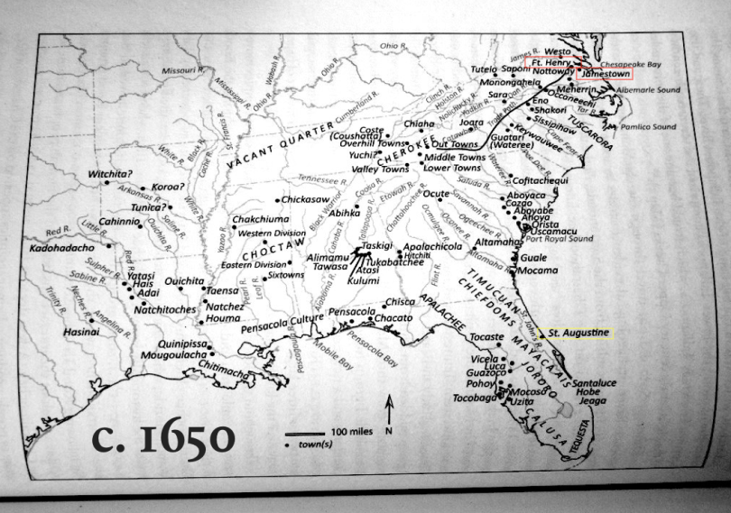
This map, from Robbie Ethridge’s From Chicaza to Chickasaw: The European Invasion and the Transformation of the Mississippian World, 1540-1715, is shocking to the eye. Few (U.S.) Americans have seen historical maps in which indigenous and colonial settlements are treated equally. (The three European towns are highlighted with red (English) and yellow (Spanish) rectangles, which I have added.) Few of us realize the vastness of the inhabited landscape of North America prior to its colonization by Europeans. History is written, and geography is mapped backward from the present to tell the story of inevitable colonial and post-Independence expansion of the United States. Without this perspective, it can seem as if history began with the arrival of European colonists, sidelining stories that predate their settlement, up to and including the vast trade in enslaved native peoples that flourished from 1685 to 1715.

Reblogged this on .
LikeLike